
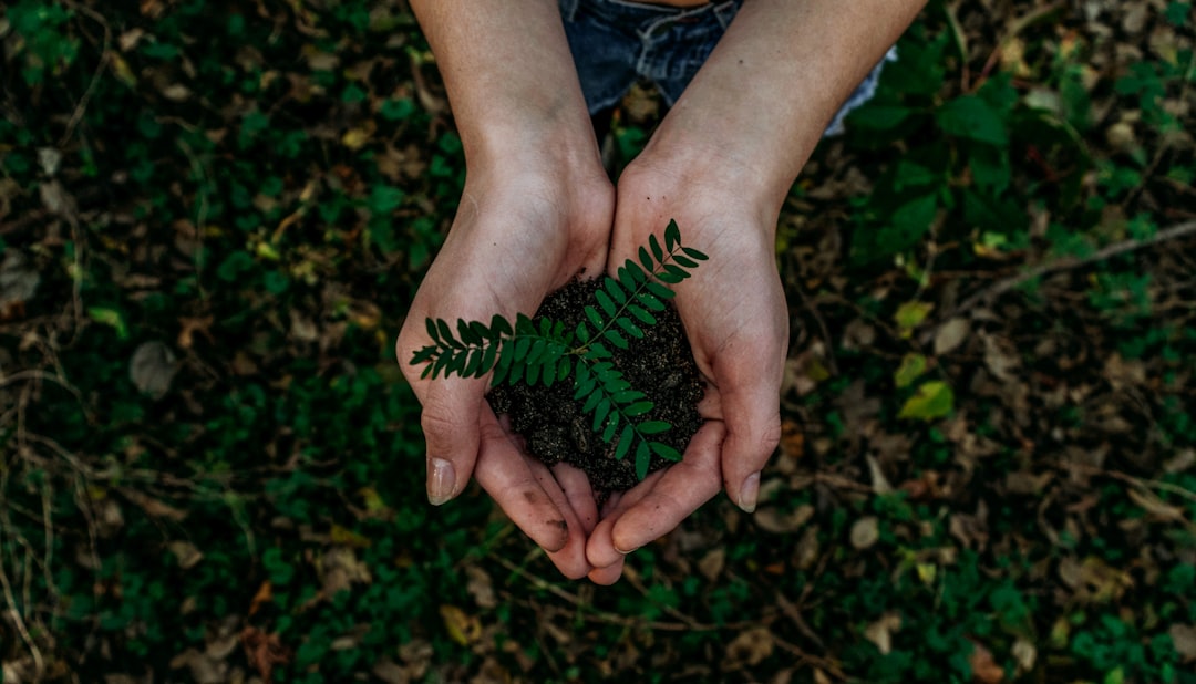
Map Your Market: Using Pollution Data to Source Cleaner, Tastier Ingredients
Use pollution maps, wind patterns, and supplier questions to source cleaner ingredients with more confidence.
Why Pollution Data Belongs in Your Ingredient Sourcing Playbook
If you care about flavor, freshness, and supply-chain trust, air quality should be part of your sourcing conversation. Public pollution maps and simple geospatial indicators can help you spot areas where industrial emissions, traffic corridors, and prevailing winds may affect farms, markets, and suppliers. That does not mean every nearby farm is compromised or every rural ingredient is automatically cleaner, but it does mean you can make smarter, more defensible buying decisions. For chefs, food buyers, and home cooks, this is a practical layer of due diligence that complements taste tests, certifications, and supplier vetting.
The idea is rooted in a broader geospatial mindset: use the best available spatial data, then interpret it with context. That approach is familiar in other industries, including the work of geospatial analysts who combine imagery, environmental layers, and local signals to create finished intelligence. The same logic applies to food sourcing, especially when you want to move from vague claims like “local” or “farm-fresh” to evidence-based clean sourcing. For a related framework on vetting sources before you buy, see our guide on how to vet a marketplace or directory before you spend a dollar.
Public environmental research also supports why this matters. Studies on industrial soot, dust, and fine particulate pollution consistently show that emissions vary sharply by location and time, often clustering around industrial corridors and urban edges. Those patterns matter to food buyers because farms, packing houses, open-air markets, and even transport routes can sit downstream of pollution plumes. If you are building a cleaner pantry or planning a menu around seasonal produce, geospatial awareness helps you ask better questions, not just rely on glossy marketing.
How Pollution Maps Work: The Three Layers You Actually Need
1) Industrial hotspots and emission clusters
The first layer to watch is the industrial hotspot layer. This is where power plants, heavy manufacturing, refineries, mining operations, and dense freight corridors tend to cluster, creating localized soot, dust, NOx, and other airborne contaminants. Even if a farm itself is not next to a smokestack, repeated exposure from a nearby industrial zone can influence the surrounding air shed. When you look at a map, don’t just check the dot for the farm; look at the surrounding industrial geography within a wider radius.
2) Wind patterns and seasonal transport
Wind direction matters because pollution moves. A farm that looks “far” from a factory on a static map may still sit directly downwind during a large portion of the growing season, while a closer site may be buffered by terrain and prevailing winds. This is why geospatial food sourcing is more than proximity math. It’s a seasonal exercise that asks: where do emissions go in spring, summer, and harvest months, and what weather patterns shape exposure?
3) Time-based variation, not just average air quality
Spatiotemporal maps are useful because pollution changes over time, not just space. An area may have cleaner air in one season and heavier exposure in another due to heating demand, dust events, crop burning, or industrial production cycles. That’s relevant for seasonal markets, especially when you want to compare what was true during the actual growing period rather than the average over the whole year. When in doubt, use the most recent and seasonally specific data you can find.
What Pollution Can Mean for Food Quality and Buyer Confidence
Freshness is not the only issue
People often think about pollution only in terms of food safety, but the story is broader. Airborne contaminants can affect crop surfaces, post-harvest handling, worker practices, and even consumer perception of cleanliness. While not every exposed farm will produce inferior food, ingredients from lower-exposure areas often come with stronger confidence when you are comparing suppliers, especially for delicate produce, herbs, leafy greens, and open-air market goods. In practice, that confidence can improve menu planning because chefs can build recipes around ingredients they trust more fully.
Flavor and handling often travel together
Cleaner sourcing is not a magic flavor switch, but lower-exposure production often correlates with better stewardship, fewer industrial disruptions, and stronger attention to crop handling. Buyers who use pollution maps alongside freshness checks may find better tasting tomatoes, herbs, lettuces, berries, and stone fruit because they are narrowing their pool to suppliers with better environmental conditions and more disciplined operations. This is the same mindset people use when shopping for specialty items with transparent sourcing, like the curated products in our inside the seafood supply chain guide, where traceability changes the buying decision.
Trust is a market advantage
For restaurant teams, trust is commercial value. Guests increasingly ask where ingredients come from, and if they cannot get a straight answer, the opportunity to build loyalty is lost. A restaurant that can say it evaluates farms based on water access, soil stewardship, and local air quality signals has a sharper story than one that simply says “locally sourced.” That same transparency helps home cooks choose smarter at farmers’ markets and seasonal produce stalls.
| Source option | What to check on a pollution map | What it can signal | Best use case |
|---|---|---|---|
| Farm stand near industrial park | Distance to hotspot, wind direction, seasonal plume path | Potential airborne deposition risk | Ask detailed sourcing questions before buying bulk produce |
| Rural farm upwind of industry | Prevailing winds, terrain barriers, seasonal changes | Lower exposure likelihood | Great candidate for premium menu items |
| Urban farmers’ market | Traffic density, nearby construction, port or rail corridors | Variable exposure around market days | Best for short-listing vendors, then verifying practices |
| Coastal supplier with freight access | Shipping lanes, port emissions, local land use | Mixed exposure profile | Useful for shelf-stable pantry sourcing |
| Community-supported agriculture network | Farm clusters and regional emission gradients | Often easier to compare across nearby sites | Strong for subscription boxes and recurring orders |
How to Read Public Pollution Maps Without Being a Data Scientist
Start with the broad layer, then zoom in
Begin with an air quality or emissions map that shows a region, then zoom toward candidate farms, markets, or suppliers. The first pass is about spotting obvious red flags: industrial clusters, major highways, shipping zones, or dense urban corridors. The second pass is about context. A farm may appear close to a hotspot but sit behind a ridge, forest buffer, or prevailing wind barrier that changes the real exposure profile.
Look for trends, not one-day snapshots
Single-day readings are useful for planning, but not enough for sourcing decisions. You want trend data that reveals whether a location is consistently exposed or only occasionally affected. That is where spatiotemporal maps are especially helpful, because they show how emissions vary by season and over time. If you are comparing vendors for a restaurant menu, you can use these patterns to decide which products deserve long-term contracts and which are better as opportunistic purchases.
Use simple proxies when maps are incomplete
You do not need perfect data to make better decisions. Even if you cannot access a sophisticated emissions model, you can still use pragmatic indicators like industrial land use, truck traffic, landfill proximity, topography, and prevailing winds. This “good enough to act” approach is common in other sourcing decisions too, such as choosing suppliers with stronger operational reliability or evaluating customer-facing directories before committing spend. For a mindset shift toward smarter comparison shopping, see stocking your kitchen with essential ingredients and why airfare moves so fast—both emphasize pattern recognition over impulse.
A Practical Checklist for Cleaner Ingredient Sourcing
Step 1: Map the site and the surroundings
Before you buy, identify the supplier’s exact location and then look five to ten miles around it. Mark industrial areas, highways, ports, rail yards, waste facilities, and construction zones. If the farm or market sits downwind from one of those areas during the main harvest months, note it as a follow-up item rather than a dealbreaker. Geography is a clue, not a verdict.
Step 2: Ask about production and harvest timing
Harvest timing matters because exposure windows change. A spring herb crop may face a different air profile than a late-summer tomato crop. Ask when the crop was planted, when it was harvested, and whether any collection or drying happened outdoors. This is especially important for dried herbs, teas, spices, and produce that undergoes sun drying, because open-air handling can matter as much as field location.
Step 3: Verify buffer practices and transport paths
Well-run farms often use hedgerows, tree buffers, covered storage, rapid post-harvest cooling, and thoughtful packing routes to reduce exposure. Ask whether they have windbreaks or whether their most sensitive plots are shielded from road dust and industrial drift. Then ask how product moves from field to storage to market. A clean-looking farm can still lose points if the post-harvest route passes through a dusty, congested industrial corridor.
Pro Tip: When you only have ten minutes, do the “three-circle test”: circle the farm, circle the market, circle the likely wind corridor. If two circles overlap with industrial hotspots, ask for extra documentation before you buy.
The Supplier Vetting Questions That Actually Reveal Risk
What to ask producers, distributors, and market managers
Supplier vetting should sound practical, not accusatory. Ask, “What major land uses are nearby?” “Do you know the prevailing wind direction during the main season?” “Are there days or months when dust or smoke exposure is higher?” “What steps do you take to protect produce after harvest?” These questions are easy for a thoughtful supplier to answer and hard for a careless one to fake. If a seller cannot answer basic location and handling questions, that is a signal in itself.
How to judge transparency
Transparency is more than a nice website. A transparent supplier can tell you where the product was grown, how it was handled, and what environmental challenges exist in the region. They do not need to promise perfection; they need to be specific. For a broader trust framework, our guide on building a trusted restaurant directory offers a useful lesson: consistency and update discipline matter more than polished branding.
What documentation helps most
The best evidence often includes farm maps, harvest logs, certifications, wind or weather notes, and third-party testing where appropriate. For market managers, vendor lists with farm names and growing regions are far more useful than generic labels. If you are comparing pantry staples or packaged ingredients, ask for batch-level traceability and sourcing notes. Consumers who already care about ingredient integrity will recognize the value of this level of detail, similar to the accountability discussed in choosing halal-friendly functional ingredients, where specification matters as much as category.
Seasonal Markets, Menu Planning, and Better Buying Windows
Why seasonality changes the air-quality conversation
Seasonal markets are ideal for geospatial sourcing because you can compare weather, emissions, and harvest timing together. Spring and summer may bring different particulate loads than autumn, especially where agricultural burning, dust, heat-driven ozone, or industrial maintenance cycles are common. For chefs, this means menu planning can incorporate not just what is ripe, but where that ingredient is coming from during that exact period. If a berry season aligns with cleaner wind patterns, that might be the moment to build a signature dessert or preserve for later use.
How chefs can use this in menu design
Chefs can think of pollution maps like a flavor-adjacent risk filter. If two farms grow beautiful carrots, but one sits in a cleaner airflow corridor, that one may be the smarter premium buy for raw dishes, garnish, or tasting menus. The other might still be perfectly fine for soups, braises, or sauces, depending on handling and washing protocols. This is where menu planning becomes strategic rather than merely creative.
How home cooks can use it at the farmers’ market
Home cooks do not need a procurement department to benefit. If you shop weekly at a farmers’ market, notice which booths consistently identify farm locations and which ones answer sourcing questions clearly. You can also ask vendors whether the farm is sheltered by hills, tree lines, or buffer zones and whether they’ve seen smoke, dust, or roadside contamination during the season. Over time, you will build a personal map of the stalls that reliably deliver cleaner, tastier produce.
From Data to Decisions: A Scoring Model You Can Actually Use
Create a simple five-factor score
To keep this manageable, score each candidate supplier from 1 to 5 on five factors: proximity to industrial hotspots, exposure to prevailing winds, transport-path cleanliness, transparency of sourcing, and harvest timing relative to high-pollution periods. A farm with a strong score does not need to be perfect; it just needs to be stronger than alternatives at the same price and quality level. This prevents you from overreacting to any single factor and keeps the buying process balanced.
Weight the factors by product type
Not all ingredients carry the same sensitivity. Leafy greens, herbs, berries, and fresh fruits may deserve heavier weighting on air-quality exposure, while shelf-stable grains and dry pantry items may lean more on processing and storage transparency. For premium tasting menus or raw applications, give environmental exposure a larger role. For cooked applications, a supplier with slightly higher exposure but excellent handling and traceability may still be your best option.
Review and update the score regularly
Because pollution is dynamic, your sourcing score should be updated seasonally. New roadwork, factory changes, wildfire seasons, and wind shifts can alter the picture quickly. That is why the best buyers treat geospatial sourcing as a living process, not a one-time audit. If you want to sharpen your comparison habits more broadly, our guide on spotting the true cost of a purchase offers a similar principle: hidden variables often matter more than the headline price.
Common Mistakes When Using Pollution Maps for Food Sourcing
Confusing proximity with exposure
Being near a road or industrial site does not automatically mean a source is unsafe or lower quality. Exposure depends on winds, terrain, barriers, and timing. This is why geospatial sourcing needs nuance. Use proximity as a first filter, not a final judgment.
Ignoring post-harvest handling
Some of the biggest quality differences happen after harvest. Even a clean farm can lose its advantage if produce sits uncovered near dust, exhaust, or smoke before washing and cooling. Ask about storage, packaging, and transport. Clean sourcing is a chain, not a single location.
Overlooking seasonal volatility
A supplier can look strong on an annual average and still be a poor fit during the exact months you need them. Seasonal markets are especially vulnerable to this mistake. If your menu depends on a product during a high-exposure period, consider a different region, a different harvest window, or a processed format that reduces reliance on open-air handling.
Pro Tip: If a supplier sounds offended by environmental questions, take that as useful data. Good operators usually welcome informed buyers because transparency is part of their value proposition.
How This Fits into a Broader Sustainability Strategy
Cleaner sourcing supports smarter purchasing
Sustainability is often framed as carbon, water, or packaging, but air quality belongs in the conversation too. When buyers choose farms and suppliers with lower airborne contaminant exposure, they often reinforce better land stewardship, smarter site planning, and stronger transparency practices. This makes procurement more resilient and more aligned with long-term quality. It also helps buyers explain why a particular supplier deserves premium placement.
It can improve resilience, not just optics
In periods of wildfire smoke, industrial disruption, or transportation congestion, businesses with geospatial awareness adapt faster. They know which suppliers are least exposed, which regions are seasonally cleaner, and where to pivot when conditions change. That flexibility is valuable for restaurants, retailers, and households that want dependable ingredients without sacrificing values. It is similar to the careful planning behind choosing the right carry-on: the best option is the one that handles real-world conditions well.
It strengthens the buyer-supplier relationship
When buyers ask informed questions, suppliers who care about quality can stand out. Instead of vague claims, you get real dialogue about local conditions, crop handling, and seasonal logistics. That leads to better partnerships and more reliable food. Over time, this can become a signature part of your sourcing identity, whether you are running a restaurant, buying for a shop, or cooking at home.
Action Plan: Your 30-Minute Geospatial Sourcing Workflow
First 10 minutes: identify the candidate
Pick one ingredient you care about, such as basil, strawberries, tomatoes, eggs, or flour. Gather three candidate farms, markets, or suppliers and note their locations. Open a pollution map and mark industrial areas, highways, ports, rail lines, and large construction zones nearby.
Next 10 minutes: compare exposure and transparency
Check wind direction, seasonal timing, and whether the supplier provides location or harvest details. Eliminate any option that cannot explain where it operates or how it handles product after harvest. Then rank the remaining options on exposure, transparency, and freshness potential.
Final 10 minutes: ask one smart question
Choose one follow-up question that reveals real operational quality, such as “What protects this crop from road dust or drift during harvest?” or “How do you route product from field to market?” This single question often tells you more than a polished brochure. For broader shopping discipline across categories, our article on true cost analysis is a good reminder that the best decision is usually the most informed one.
FAQ: Pollution Maps and Food Sourcing
Do pollution maps prove food is unsafe?
No. They help you estimate exposure risk and ask smarter questions, but they do not diagnose contamination on their own. Use them as part of a broader sourcing and quality review.
How far from an industrial area is “far enough”?
There is no universal distance because wind, terrain, and land use all matter. A site several miles away may still be affected if it is downwind, while a closer site may be relatively buffered.
Are farmers’ markets usually cleaner than supermarkets?
Not automatically. Farmers’ markets can be excellent sources, but the key is transparency about the farm location, growing conditions, and handling practices. A market stall with clear sourcing can be better than a vague supermarket label.
What ingredients deserve the most attention?
Start with delicate fresh foods: leafy greens, herbs, berries, and fruits eaten raw. Then consider dried products and anything that is open-air handled or sun dried. Shelf-stable goods usually need a different risk lens.
Can small home cooks really use this method?
Yes. Even a simple check of nearby industrial land use, traffic corridors, and seasonal winds can improve your shopping decisions. You do not need advanced tools to make better choices.
What if a supplier is local but the map looks concerning?
Ask about windbreaks, buffer zones, harvest timing, washing, and storage. Local can still be a great choice, but proximity alone should not override environmental context.
Related Reading
- Inside the Seafood Supply Chain: Transparency for Conscious Consumers - A practical look at traceability, sourcing claims, and what transparency should really look like.
- How to Build a Trusted Restaurant Directory That Actually Stays Updated - Useful lessons on keeping vendor information accurate and reliable over time.
- Cooking like the Pros: Stocking Your Kitchen with Essential Ingredients from Costco - A smart framework for balancing quality, value, and pantry planning.
- How to Choose Halal-Friendly Functional Ingredients for Everyday Cooking - A sourcing guide focused on ingredient clarity and trust.
- Hidden Fees Are the Real Fare: How to Spot the True Cost of Budget Airfare Before You Book - A powerful reminder to evaluate the full picture before committing.
Related Topics
Maya Sterling
Senior SEO Editor & Food Sourcing Strategist
Senior editor and content strategist. Writing about technology, design, and the future of digital media. Follow along for deep dives into the industry's moving parts.
Up Next
More stories handpicked for you

The Art of Sourcing: How Local Ingredients Elevate Your Home Cooking

Crossover Cuisine: Recipes Inspired by Popular Games

Uber's Community Initiative: How Local Food Impact Drives Growth
Sustainable Packaging Practices: What Your Snack Brands Should Be Doing

Grocery Shopping Options: The Cost of Discounts Based on Location
From Our Network
Trending stories across our publication group

Taste the Place: How Agritourism Can Teach Families to Eat Seasonally and Support Local Food Traditions

Mobile Micro‑Mills: How Prefabrication and Modular Design Could Revolutionise Small‑Batch Olive Oil Production

A Consumer’s Guide to Buying Olive Oil from Low‑Pollution Regions

Battle of the Brands: Healthy Food Retail Wars in 2026

Choosing Ethical Brands: A Guide to Sustainable Food Options